Android-使用webview在V3版的Google地圖GPS定位
目的:透過GPS或網路定位來決定裝置目前的位置
https://www.youtube.com/watch?v=_Bw2YP39WOw
畫面中可看到經緯度的資料約每隔一秒更新一次。
測試時必須要用GPS的模擬器播放預存的GPS記錄檔(KML)來模擬實際GPS抓到定位的資料,如下畫面:

程式要能接收GPS或網路的定位資料必須實作LocationListener介面,其中有幾個介面方法可以用在實際上的程式撰寫,像是定位資料的變化的相關方法「public void onLocationChanged(Location location」,其他像是偵測GPS裝置是否啟動或不啟動的方法。
主程式:
package wells.example.googlemapexample;
import android.app.Activity;
import android.content.Context;
import android.location.Criteria;
import android.location.Location;
import android.location.LocationListener;
import android.location.LocationManager;
import android.os.Bundle;
import android.view.View;
import android.webkit.WebView;
import android.webkit.WebViewClient;
import android.widget.Button;
import android.widget.EditText;
public class MainActivity extends Activity implements LocationListener{
private static final String MAP_URL = "file:///android_asset/googleMap.html";
private WebView webView;
private EditText LatText, LogText;
private Button submit;
private boolean webviewReady = false;
private Location mostRecentLocation = null;
private void getLocation() {//取得裝置的GPS位置資料
LocationManager locationManager =
(LocationManager)getSystemService(Context.LOCATION_SERVICE);
Criteria criteria = new Criteria();
criteria.setAccuracy(Criteria.ACCURACY_FINE);
String provider = locationManager.getBestProvider(criteria,true);
//In order to make sure the device is getting the location, request updates.
locationManager.requestLocationUpdates(provider, 1, 0, this);
mostRecentLocation = locationManager.getLastKnownLocation(provider);
}
@Override
/** Called when the activity is first created. */
public void onCreate(Bundle savedInstanceState) {
super.onCreate(savedInstanceState);
setContentView(R.layout.googlemaps);
LatText = (EditText) findViewById(R.id.LatText);
LogText = (EditText) findViewById(R.id.LogText);
submit = (Button) findViewById(R.id.submit);
submit.setOnClickListener(new Button.OnClickListener(){
@Override
public void onClick(View v) {
// TODO Auto-generated method stub
if (webviewReady) {
//由輸入的經緯度值標註在地圖上,呼叫在googlemaps.html中的mark函式
final String markURL = "javascript:mark(" +
LatText.getText() + "," +
LogText.getText() + ")";
webView.loadUrl(markURL);
//畫面移至標註點位置,呼叫在googlemaps.html中的centerAt函式
final String centerURL = "javascript:centerAt(" +
LatText.getText() + "," +
LogText.getText() + ")";
webView.loadUrl(centerURL);
}
}
});
getLocation();//取得定位位置
setupWebView();//設定webview
if (mostRecentLocation!=null){
LatText.setText("" + mostRecentLocation.getLatitude());
LogText.setText("" + mostRecentLocation.getLongitude());
//將畫面移至定位點的位置
final String centerURL = "javascript:centerAt(" +
mostRecentLocation.getLatitude() + "," +
mostRecentLocation.getLongitude()+ ")";
if (webviewReady) webView.loadUrl(centerURL);
}
}
/** Sets up the WebView object and loads the URL of the page **/
private void setupWebView(){
webView = (WebView) findViewById(R.id.webview);
webView.getSettings().setJavaScriptEnabled(true);
//Wait for the page to load then send the location information
webView.setWebViewClient(new WebViewClient(){
@Override
public void onPageFinished(WebView view, String url)
{
//webView.loadUrl(centerURL);
webviewReady = true;//webview已經載入完畢
}
});
webView.loadUrl(MAP_URL);
}
@Override
public void onLocationChanged(Location location) {//定位位置改變時會執行的方法
// TODO Auto-generated method stub
if (location !=null){
LatText.setText("" + location.getLatitude());
LogText.setText("" + location.getLongitude());
//將畫面移至定位點的位置,呼叫在googlemaps.html中的centerAt函式
final String centerURL = "javascript:centerAt(" +
location.getLatitude() + "," +
location.getLongitude()+ ")";
if (webviewReady) webView.loadUrl(centerURL);
}
}
@Override
public void onProviderDisabled(String provider) {
// TODO Auto-generated method stub
}
@Override
public void onProviderEnabled(String provider) {
// TODO Auto-generated method stub
}
@Override
public void onStatusChanged(String provider, int status, Bundle extras) {
// TODO Auto-generated method stub
}
}
專案必須打開的權限:
<uses-permission android:name="android.permission.INTERNET"/>
<uses-permission android:name="android.permission.ACCESS_COARSE_LOCATION" />
<uses-permission android:name="android.permission.ACCESS_FINE_LOCATION" />
googlemaps.xml
<LinearLayout xmlns:android="http://schemas.android.com/apk/res/android"
android:layout_width="fill_parent"
android:layout_height="fill_parent"
android:focusable="true"
android:focusableInTouchMode="true"
android:orientation="vertical" >
<RelativeLayout
android:id="@+id/RelativeLayout1"
android:layout_width="fill_parent"
android:layout_height="133dp"
android:focusable="true"
android:focusableInTouchMode="true" >
<TextView
android:id="@+id/textView2"
android:layout_width="wrap_content"
android:layout_height="wrap_content"
android:layout_centerVertical="true"
android:text="緯度(Latitude)"/>
<EditText
android:id="@+id/LogText"
android:layout_width="wrap_content"
android:layout_height="wrap_content"
android:layout_alignParentRight="true"
android:layout_alignParentTop="true"
android:layout_toRightOf="@+id/textView1"
android:layout_weight="1"
android:clickable="false"
android:ems="10"
android:inputType="text"
android:text="120.580806" />
<TextView
android:id="@+id/textView1"
android:layout_width="wrap_content"
android:layout_height="wrap_content"
android:layout_alignParentLeft="true"
android:text="經度(Longtitude)" />
<EditText
android:id="@+id/LatText"
android:layout_width="wrap_content"
android:layout_height="wrap_content"
android:layout_alignBaseline="@+id/textView2"
android:layout_alignBottom="@+id/textView2"
android:layout_alignParentRight="true"
android:ems="10"
android:focusable="false"
android:focusableInTouchMode="false"
android:inputType="text"
android:text="24.217712" >
<requestFocus />
</EditText>
<Button
android:id="@+id/submit"
android:layout_width="wrap_content"
android:layout_height="wrap_content"
android:layout_alignLeft="@+id/LatText"
android:layout_alignParentBottom="true"
android:focusable="false"
android:focusableInTouchMode="false"
android:text="標註" />
</RelativeLayout>
<WebView
android:id="@+id/webview"
android:layout_width="fill_parent"
android:layout_height="629dp" />
</LinearLayout>
googleMap.html
<!DOCTYPE html>
<html>
<head>
<meta charset="utf-8">
<title>Google Maps JavaScript API v3 Example: Marker Animations</title>
<link href="/maps/documentation/javascript/examples/default.css" rel="stylesheet">
<script src="https://maps.googleapis.com/maps/api/js?sensor=false"></script>
<script>
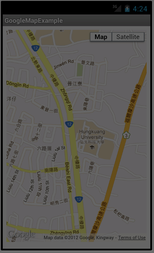
var centerPoint = new google.maps.LatLng(24.217712, 120.580806); //弘光科技大學,台中市中棲路34號
var marker;
var map;
var image = 'taxi-icon.png';//image變數指向計程車圖示檔案,圖示檔案請放在相同目錄
function mark(lat, log){//標註座標函式
var m = new google.maps.LatLng(lat, log);
marker = new google.maps.Marker({
map:map,
draggable:true,
position: m,
icon: image //指定標示圖案為image
});
}
function initialize() {
var mapOptions = {
zoom: 15,
mapTypeId: google.maps.MapTypeId.ROADMAP,
center: centerPoint
};
map = new google.maps.Map(document.getElementById('map_canvas'),
mapOptions);
}
function centerAt(latitude, longitude){//地圖以給予的座標為中心,即移動地圖至給定的座標
myLatlng = new google.maps.LatLng(latitude,longitude);
map.panTo(myLatlng);
}
</script>
</head>
<body onload="initialize()">
<div id="map_canvas" style="width: device-width; height: 460px;">map div</div>
</body>
</html>
專案目錄:


Comments
我最近剛好在做畢業專題,面臨到google從v2改成v3,可以參考的資料變得很少!
感謝有您的部落格教學,讓我省了不少麻煩:)
剛接觸這領域的東西,也請您多多指教,謝謝您。